
Derbyshire weather: Amber warnings issued for snow and ice across East Midlands - full forecast

Snow is forecast in Derbyshire and the wider region this weekend with more severe amber warnings now issued by the Met Office
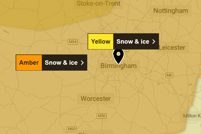
An amber weather warning for snow and ice covering the West Midlands is in place from 6pm on Saturday to Sunday night, the Met Office has said.
Temperatures are expected to drop between 0 degrees and -1 degrees at the weekend.
Amber warnings are also in place in the East Midlands, including Derbyshire and Nottinghamshire. In Nottingham, the combined snow and ice warning runs between 12:00 (UTC) on Saturday, January 4, 2025 and 23:59 (UTC) on Sunday, January 5, 2025.
Freezing rain is to be expected across Nottinghamshire and Derbyshire and the wider East Midlands. In addition, as milder air moves northwards, snow may turn to a spell of freezing rain for a time, again more especially across the Midlands, adding to the risk of ice and leading to some treacherous conditions in places.

What should I expect with Amber snow warning?
- Some rural communities cut off
- Power cuts and other services, such as mobile phone coverage, affected
- Delays and cancellations to rail and air travel is expected
- Travel delays on roads, stranding some vehicles and passengers
Midlands forecast this weekend
Saturday, January 4
A dry and cold start but turning increasingly unsettled with rain, sleet and disruptive snow pushing in from the southwest through the afternoon accompanied by stronger winds. Maximum temperature 4 °C.
Outlook for Sunday to Tuesday
Remaining unsettled but slightly milder on Sunday with the risk of freezing rain to start, turning back to rain later. Drier on Monday and Tuesday with a few wintry showers.